Integrated survey of Faskally Forest
2026
Location:
Faskally Forest, Pitlochry, Scotland
Industry:
Local Authority / Asset Management
Background
When you're planning structural repairs or alterations to reinforced concrete assets, it's crucial to understand exactly what lies beneath the surface. Drilling into concrete without knowing the location of reinforcement bars can create unnecessary risks and delay construction programmes.
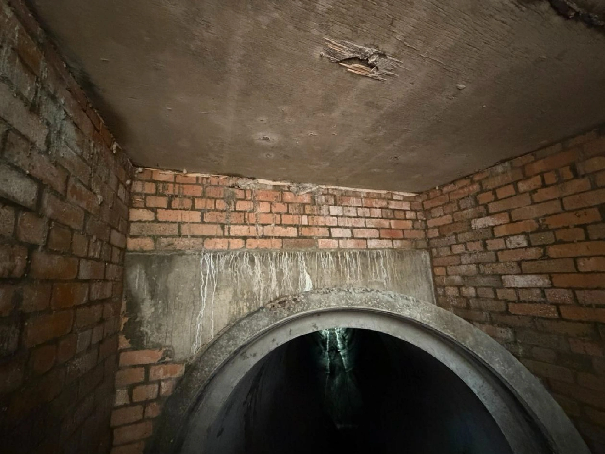
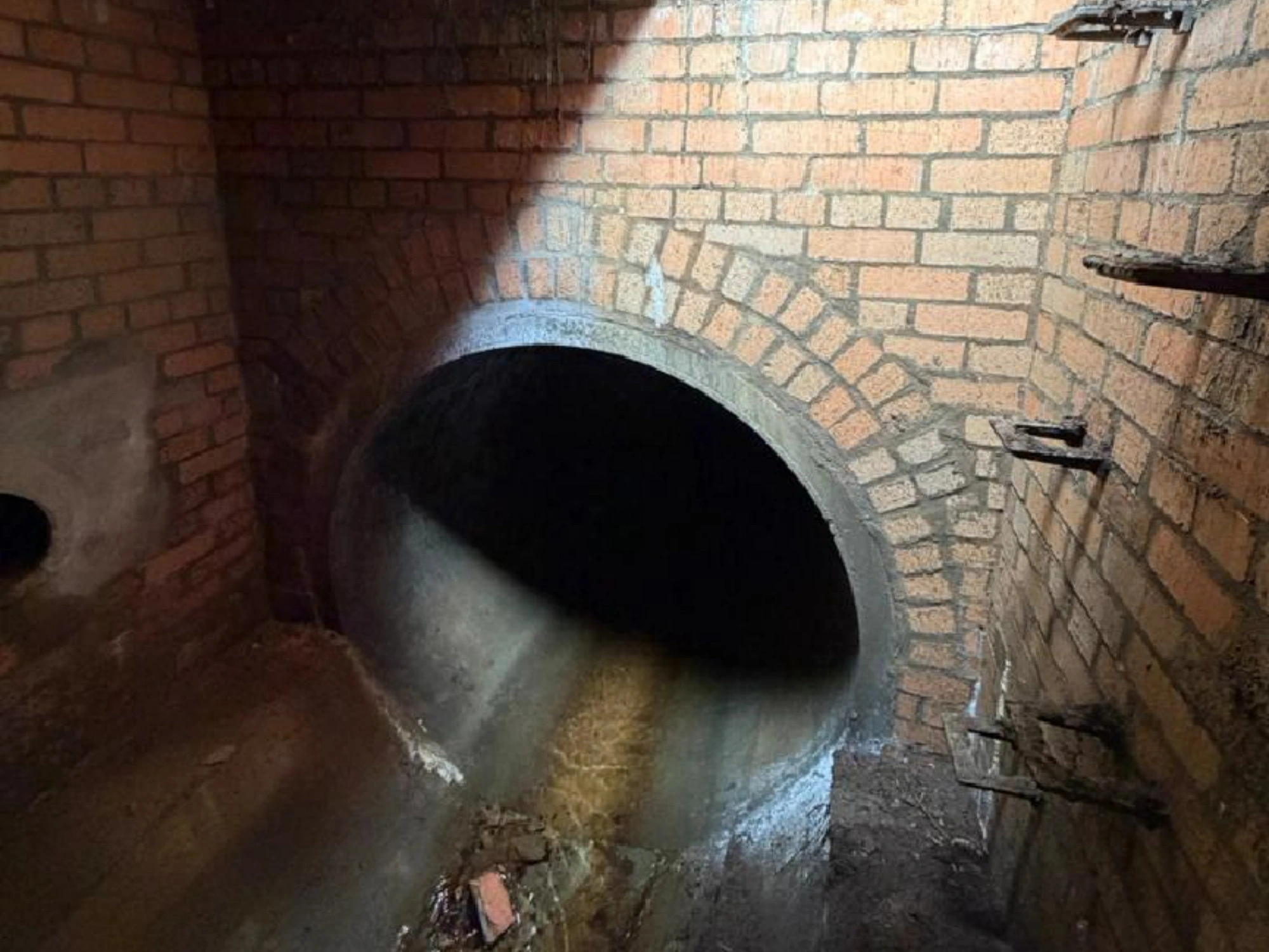
We were commissioned to carry out a detailed non-destructive structural survey of a confined concrete chamber within Faskally Forest, near Pitlochry in Scotland.
The survey would provide the client with accurate information about the internal structure of the chamber, allowing future works to be designed safely and efficiently without damaging the existing asset.
The project also provided an opportunity to demonstrate one of our specialist capabilities, which is combining advanced survey technologies with trained confined space survey teams to deliver high-quality data in locations that are often difficult or hazardous to access.
The challenge
Working within a confined space brought plenty of its own challenges. The restricted environment limited access and required carefully controlled working practices. Meanwhile, the client also needed a clear understanding of the chamber's structural makeup to reduce uncertainty during the design and construction stages.
Traditional investigative methods would have involved drilling into the concrete to expose reinforcement, increasing both programme time and cost while permanently affecting the structure.
Instead, the client wanted a non-destructive survey that would accurately identify the position of the reinforcement while providing a complete digital record of the chamber.
Our approach
To achieve this, we delivered a fully integrated survey combining:
- 3D laser scanning to capture a complete digital model of the structure
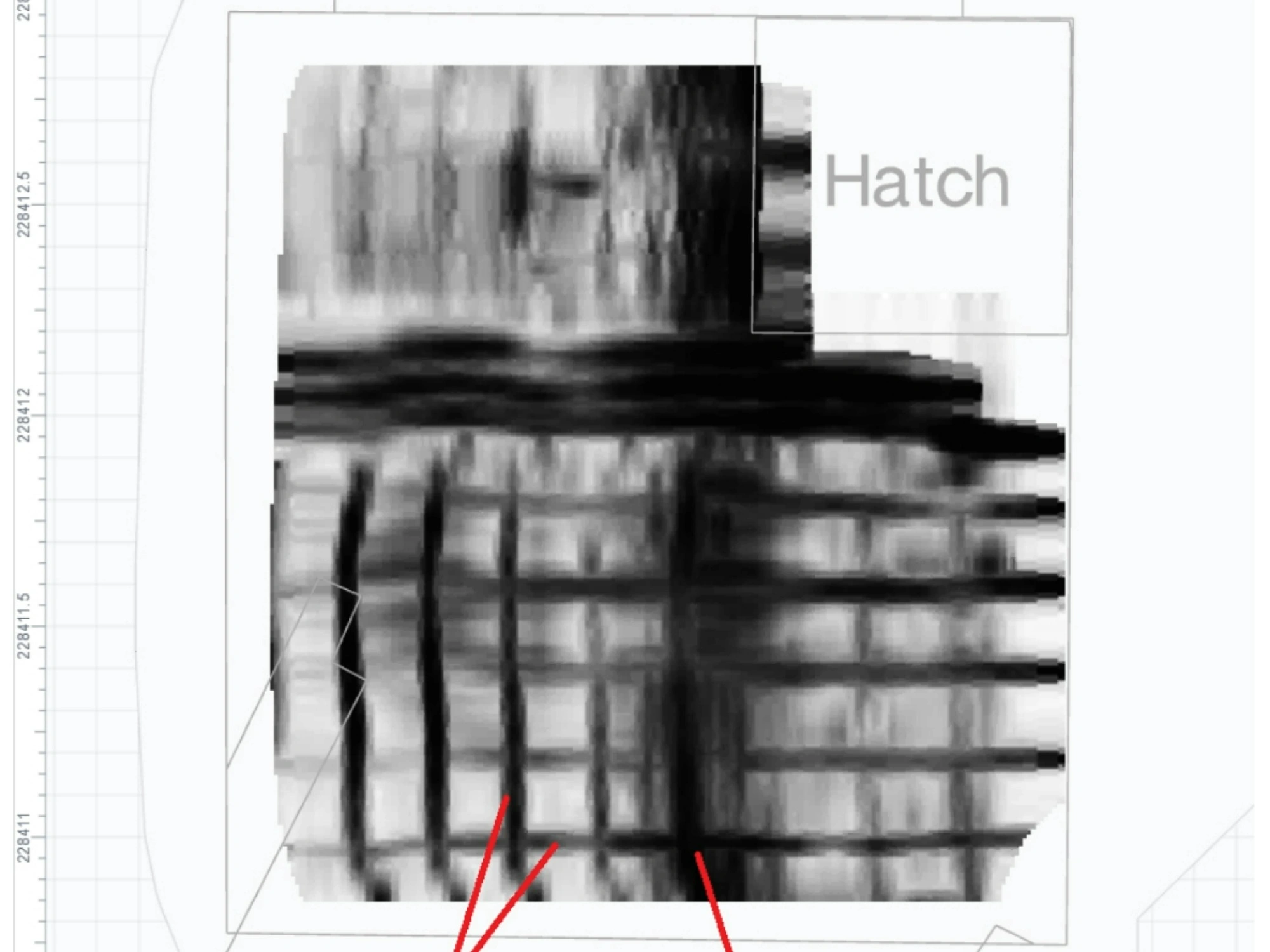
- Ground Penetrating Radar (GPR) to confirm the position and depth of the reinforcement
- Ferroscan technology to estimate reinforcement bar diameter while providing a second layer of confirmation for the position and depth of cover.
Rather than relying on just one survey technique, we used these technologies together to build a much clearer picture of the structure. The laser scan recorded every visible surface in high detail, producing a precise three-dimensional point cloud that engineers could interrogate long after the site visit.
GPR then identified where the reinforcement sat beneath the concrete surface, while Ferroscan verified those findings and provided additional information about the reinforcement itself.
By integrating the outputs from each survey, we were able to provide the client with reliable structural data without any need for any destructive investigation methods.
We carried out all works under controlled conditions by trained personnel. This allowed us to complete the survey safely while maintaining the high levels of accuracy needed for engineering decisions in the future.
What we delivered
The completed survey gave the client a detailed understanding of both the visible structure and the reinforcement concealed within it.
Deliverables included:
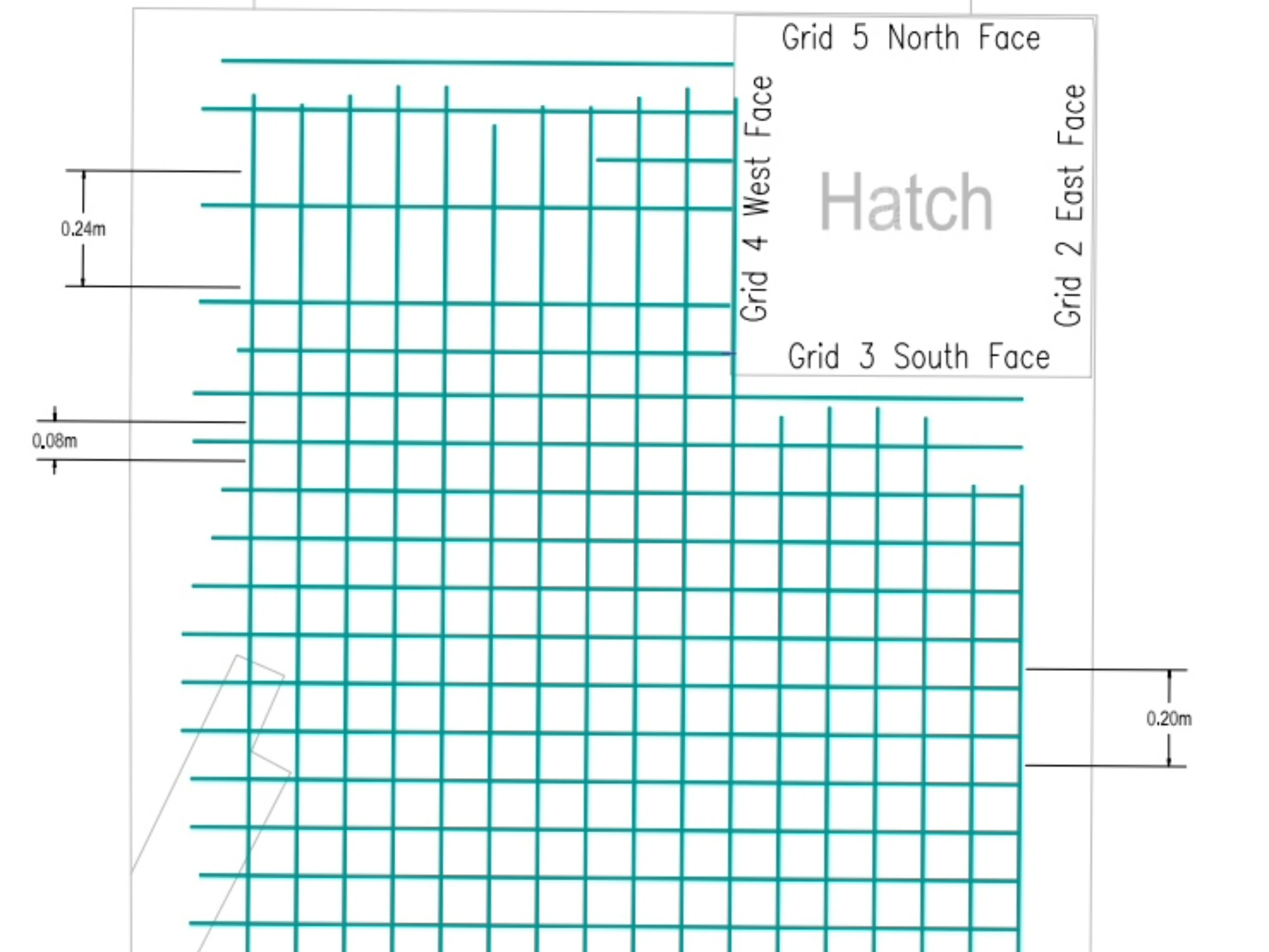
- Accurate reinforcement layout showing spacing, depth, and estimated bar diameter
- High-resolution 3D point cloud and imagery
- Clear CAD drawings and technical reporting
- Reliable data obtained through entirely non-destructive testing
The combination of these deliverables gave the client's engineers far more than a series of isolated measurements. They received a complete digital representation of the chamber together with accurate reinforcement mapping that could be incorporated directly into future design work.
Because the survey was entirely non-invasive, the integrity of the structure remained unchanged throughout the investigation. This reduced project risk while removing the need for unnecessary repair work following exploratory investigations.
The outcome for the client
The survey gave the client the confidence to move forward with the next phase of the project, backed by accurate information rather than assumptions about the existing structure.
The detailed reinforcement mapping allowed engineers to understand exactly where reinforcement was located before any construction activity began. This supported better-informed design decisions while reducing the likelihood of unexpected discoveries once work was underway.
The project also showed the wider benefits of non-destructive surveying. By avoiding intrusive investigation, the client reduced both programme time and costs, all while protecting the existing concrete structure from unnecessary damage.
Key benefits included:
- Reduced project risk through a better understanding of the existing structure
- Better-informed engineering and construction decisions
- Time and cost savings by avoiding intrusive investigations
- Greater confidence that future works could be planned in line with industry standards
Perhaps most importantly, the survey delivered all of this while maintaining safe working practices inside a confined environment.

Our capability
We completed all works safely within the confined space under carefully controlled conditions, supported by our ongoing investment in specialist training.
Our survey teams have recently completed enhanced Confined Spaces with EEBA (Emergency Escape Breathing Apparatus) training, along with emergency procedures that allow us to work safely within restricted environments where many surveying companies can’t operate.
By combining specialist confined space expertise with advanced survey technologies like laser scanning, GPR, and Ferroscan, we deliver surveys that reduce risk and provide clients with the information they need to plan complex projects.
Whether supporting infrastructure upgrades, asset management programmes or structural investigations, our integrated approach provides reliable digital data while protecting both existing structures and the people working around them.
Related Services