3D MODELLING & BIM SURVEYS
CHARTERED LAND SURVEYORS
At Malcolm Hughes, we can turn information into insight
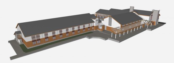
Our expert surveyors at Malcolm Hughes are experienced in capturing data and selecting the right workflows to provide 3D modelling and BIM (Building Information Modelling) surveys. This allows others in the process to utilise the information and track changes throughout a project’s life cycle, which in turn aids improved communication and collaboration.
We have a dedicated team that works with clients to provide the most appropriate survey solutions to any 3D modelling or BIM project. Surveys are carried out either by laser scanning to produce a 3D point cloud of the site area, or by conventional means with a total station measuring 3D point data.
Working in close cooperation with you, we can tailor our output to suit the needs of your individual project, utilising standard object libraries to produce data output in various formats, including RVT and IFC.
Related Case Studies
Mayfield Park, Manchester
It was a privilege to contribute our expertise to such a significant and collaborative effort, especially in a location close to our hearts, Mayfield Park is an ambitious renewal project that required multiple services from our experts.
Blackhorse Road, London
This project on a London Trams rail bridge utilised several of the services available here at Malcolm Hughes, highlighting our expertise in a variety of areas.