Foss River Bed Survey – City of York Council

2021-01-18T09:24:56+00:00February 12th, 2019|Hydrographic, Photos in the Field|

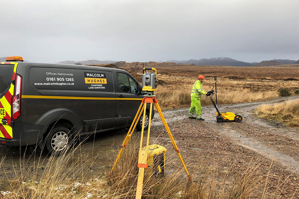
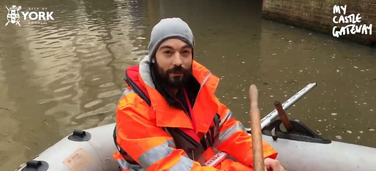
An interesting video from the City of York Council, featuring Mike from Malcolm Hughes. Mike and the team of surveyors carried out a river bed surveys on the River Foss to measure the water depth and condition of the water bed. They also performed topographical surveys of the surrounding area.

40 Years In Surveying

2021-01-18T09:26:26+00:00February 28th, 2018|Hydrographic, Photos in the Field, Staff, Topographical|

William Montgomery, Malcolm Hughes Surveyor. Today sees the retirement of William Montgomery, a surveyor at Malcolm Hughes for over thirty years and over forty years in the surveying industry. Below he shares his knowledge of how the industry has developed and what instrumentation was used through the decades.

Stunning views in the Highlands

2021-01-18T09:26:37+00:00February 20th, 2018|Photos in the Field, Topographical|

Following on from last weeks post, here are some more stunning views of the Highlands during another project for client. Photos are courtesy of Vincent O'Kane. To learn more about how Malcolm Hughes can help you, contact us at surveythis@mhls.co.uk or visit our services page for more information.

Topographical and Underground Surveys in the Highlands

2021-01-18T09:33:13+00:00February 16th, 2018|Topographical, Underground|

Malcolm Hughes were undertaking topographical and underground utility mapping surveys across a number of small, mostly remote Scottish Water treatment works for the installation of back-up power generators. Both surveys were undertaken to client supplied specifications and also in accordance with our standard survey methodology which follow both RICS Guidance

Go to Top