Foss River Bed Survey – City of York Council

2021-01-18T09:24:56+00:00February 12th, 2019|Hydrographic, Photos in the Field|

An interesting video from the City of York Council, featuring Mike from Malcolm Hughes. Mike and the team of surveyors carried out a river bed surveys on the River Foss to measure the water depth and condition of the water bed. They also performed topographical surveys of the surrounding area.

“I didn’t know it was there!”

2021-01-18T09:25:01+00:00February 8th, 2019|Photos in the Field, Underground|

A recent news article highlights the problems with vital underground utilities, the lack of knowledge when digging/breaking ground and how this lack of understanding can drastically effect the lives of others and at a substantial financial cost! Here at Malcolm Hughes we use a consultancy and advisory approach to the

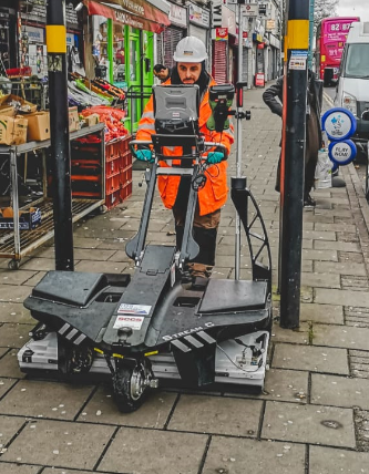
Dudley Road; PAS128 M4(P) Utility Mapping Survey using the Stream C GPR system

2021-01-18T09:25:06+00:00February 8th, 2019|Uncategorized|

Malcolm Hughes is currently undertaking a complex PAS128 utility mapping survey of Dudley Road, Birmingham. This project involves 2 kilometres of detailed utility survey work along one of Birmingham’s major roads into the city. The specification for this survey; PAS128 M4(P) involves the highest level of Survey Type B Methodology

Go to Top