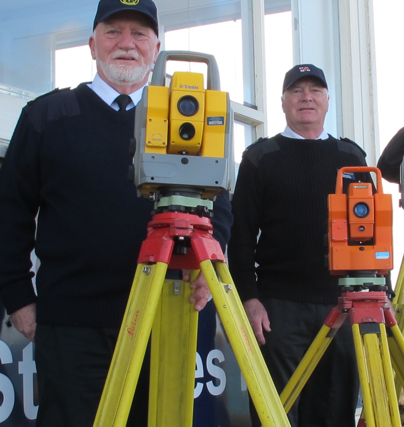
MHLS donate equipment to St Agnes Head NCI Station

2021-05-26T13:16:00+00:00January 25th, 2021|Laser Scanning, News|

MHLS presents the 3 instruments to Jim Jefferis and Chris Angove at the NCI station St Agnes Head.    St Agnes Head NCI station have just taken delivery of a number of digital Surveyors Theodolites which have been kindly donated by Malcolm Hughes Land Surveyors. The theodolites were up for

MHLS working on national infrastructure and essential works projects

2021-01-18T09:23:29+00:00January 15th, 2021|Buildings, Laser Scanning, Photos in the Field|

A New Year and another new project for Malcolm Hughes incorporating laser scanning and UAV surveys. We are working nationally on various national infrastructure and essential works projects. All jobs are being dynamically risk-assessed in line with and above the Government guidelines.

Malcolm Hughes invests in Leica RTC360 laser scanners

2021-01-18T09:23:43+00:00November 9th, 2020|Laser Scanning, News, Ogilvie Group|

Due to continued growth and development Malcolm Hughes are delighted to announce a significant investment of an additional 8 x Leica RTC360 laser scanners and associated software packages for a full field to finish tailored solution inclusive of Cyclone Register360, Cyclone Publisher & Cloudworx Ultimate (Autodesk suite). Malcolm Hughes Land

Malcolm Hughes carries out utility survey on Hampden Park

2021-01-18T09:26:00+00:00June 27th, 2018|Buildings, Laser Scanning, News, Topographical|

Malcolm Hughes surveyors have recently carried out a Utility -PAS128 Type B (detection) survey at Hampden Park. The survey area includes the carparks outside Hampden Park and also Lesser Hampden, the home of Queens Park. The work is being completed in preparation for Euro 2020 where Hampden Park will be

Ground Penetrating Radar used on Inverclyde cemetery

2021-01-18T09:26:10+00:00April 12th, 2018|3D Scanning, Laser Scanning, Topographical, Underground|

Malcolm Hughes Land Surveyors have been undertaking works at a cemetery in Inverclyde in an attempt to identify buried grave stones and individual grave plots using Ground Penetrating Radar (GPR). Our surveyors used a dual frequency GPR system to undertake the survey which on its own gives excellent detection capabilities.

Laser scanning at Cyfartha Ironworks

2021-01-18T09:34:40+00:00October 24th, 2016|3D Scanning, Laser Scanning|

Cyfartha Iron Works in South Wales were founded in 1765, and by 1806 had become the largest in the world. Currently large portions of the original enormous complex that formed the ironworks remain intact today; this includes six of the original blast furnaces. The structure is important due to the

Go to Top