Client background
Uniper Technologies Ltd. appointed Malcolm Hughes to execute a coordinated programme of geospatial surveys across multiple sites to gain knowledge about the sites for future energy infrastructure work.
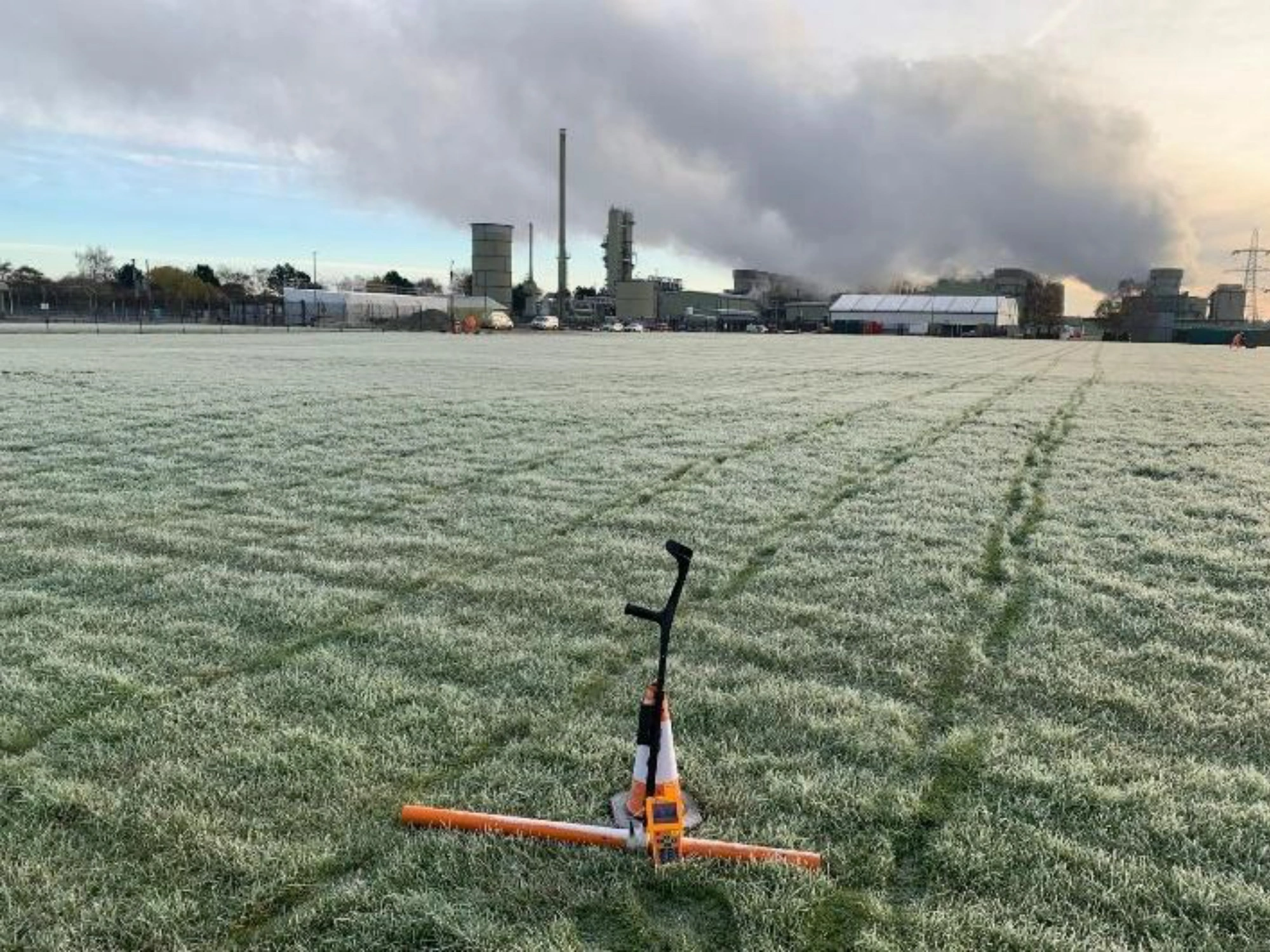
Uniper Technologies Ltd. is a major European energy company, playing a key role in delivering secure and reliable energy supply while supporting the transition to low-carbon power generation. The programme of works supported Uniper’s Connah’s Quay Low Carbon Power project, a major energy infrastructure initiative designed to deliver flexible low-carbon electricity generation as part of the UK’s transition to a decarbonised energy system. Connah’s Quay power station is a natural gas-fired plant that generates electricity for the UK grid using combined-cycle gas turbine technology.
With a strong track record in delivering complex, safety-critical survey projects, we were chosen for this project due to depth of experience, advanced technical capability, and trusted industry accreditations.
The challenge
Delivering survey data across active energy infrastructure sites presented several technical and operational challenges. Connah’s Quay, a deep tidal drainage system with fast-flowing water, presented complicated subsurface conditions for the team to work with.
Furthermore, the team was faced with many key areas of the site being inaccessible or with restricted access. Finally, the team had to adapt to minimise disruptive activity while working around the active power generation operations.
The solution
Client deliverables
Delivered in coordinated phases under strict safety controls, the programme spanned multiple sites and infrastructure environments, including Connah’s Quay, Cottam Development Centre, and key transport corridors. By coordinating multiple survey disciplines into a single geospatial programme, Malcolm Hughes provided Uniper with a comprehensive understanding of site conditions, creating a reliable foundation for design, planning and future works while minimising disruption throughout delivery.
Topographic and PAS 128 utility surveys
Comprehensive topographic and PAS128 utility surveys were carried out across Connah’s Quay and Cottam Development Centre, including detailed mapping along approximately 185m of cooling water infrastructure.
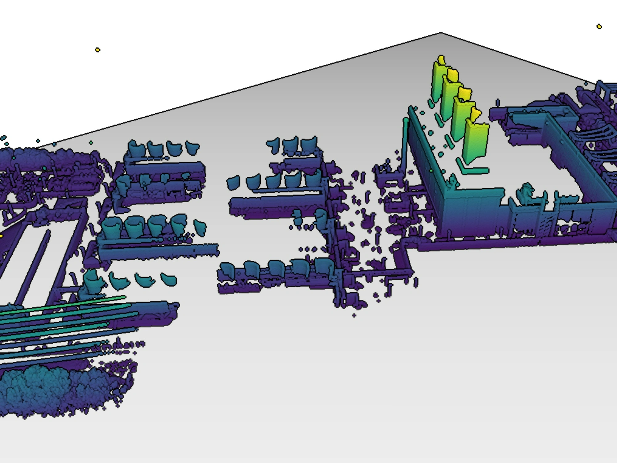
This provided clear visibility of underground utilities, reducing uncertainty and significantly minimising the risk of service strikes during future excavation works. It also supported accurate planning and design integration.
Geophysical investigation (GPR and resistivity)
Comprehensive topographic and PAS128 utility surveys were carried out across Connah’s Quay and Cottam Development Centre, including detailed mapping along approximately 185m of cooling water infrastructure.
This provided clear visibility of underground utilities, reducing uncertainty and significantly minimising the risk of service strikes during future excavation works. It also supported accurate planning and design integration.
Terrestrial laser scanning
High-resolution laser scanning was used to capture detailed spatial data in restricted and hazardous areas, with surveys undertaken safely from outside the fenceline.
This ensured complete and accurate data capture without needing physical access. This ultimately maintained safety while supporting smooth integration into design models and improving coordination across disciplines.
Driven LiDAR mobile mapping
Driven LiDAR surveys were carried out using the Leica Pegasus: Two Ultimate system, capturing high-density 3D geospatial data at normal traffic speeds across key infrastructure routes.
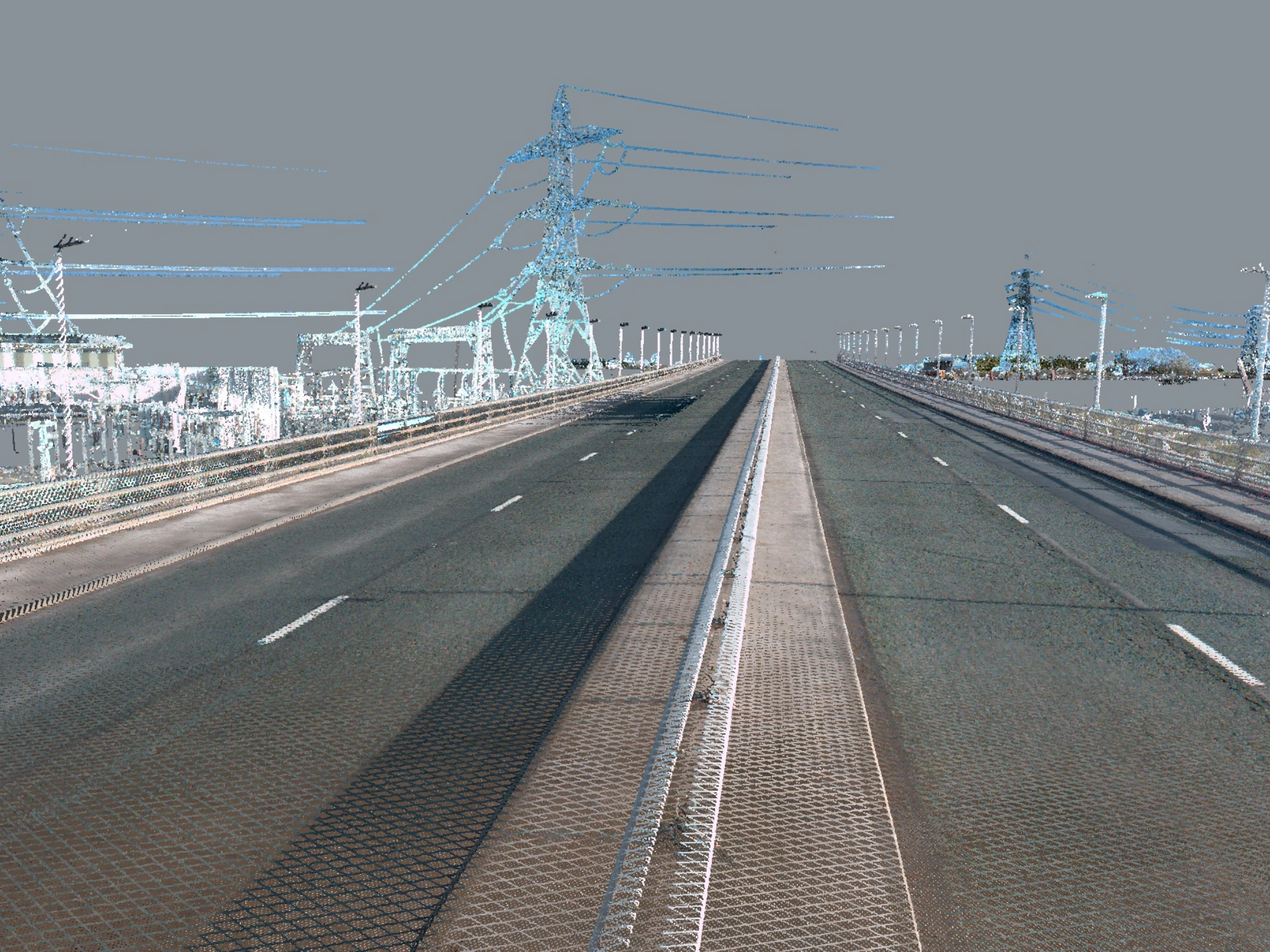
This enhanced understanding of surrounding infrastructure networks and supported wider planning across transport corridors. It also increased efficiency and reduced disruption on-site by eliminating the need for on-foot data collection.
Measurable results
Malcolm Hughes was able to provide Uniper with a strong foundation of data through high-accuracy mapping. This instilled confidence in the client that the infrastructure planning was doable and most importantly, safe.
Our unified approach mitigated project risks, which, in turn, reduced the potential for utility strikes and unforeseen subsurface delays. We managed to carry this out all while ensuring zero disruption to the active power generation operations.
Finally, by using advanced remote scanning and mobile mapping technologies, the team achieved high levels of safety for both themselves and the on-site workers, executing comprehensive data collection in hazardous environments.
Summary
We were able to provide Uniper with a clear and reliable understanding of site conditions across multiple assets and environments, enabling confident progression of complex infrastructure works with reduced risk and minimal disruption.
By delivering a coordinated geospatial approach across multiple disciplines and sites, Malcolm Hughes supported both immediate project needs and future development stages. It’s projects like this that solidify our capability and consistency, making us the ideal partner to the energy sector.
Get in touch today to explore how a tailored geospatial approach can add value and confidence to every stage of your energy infrastructure project.