Why monitoring matters during live bridge construction
Because bridge construction teams work near active motorways or railways, public safety and programme delays are at stake, leaving very little room for error. Mitigating these risks means taking away any uncertainty on site. The way to do this is to get the most up-to-date, detailed data about the environment’s activity is through live monitoring with geospatial technology.
Sites who use a three-phase monitoring plan aren’t just improving their credibility rating with local authorities; they’re taking a proactive approach to their project, ensuring safety risks are reduced to an absolute minimum and decision-making is as efficient as it can be.
This infrastructure insight will take you through the necessity of partnering with a professional geospatial team to conduct expert bridge health monitoring, protecting people, assets, and reputation.
Monitoring during live bridge construction
When used for bridge construction, monitoring takes into account the structure and everything surrounding it. When working over active rail lines or busy motorways, variables can change in an instant, making monitoring crucial. Monitoring during construction helps to highlight multiple different aspects of the project:
Structural movement
Bridges are built to move in order to prevent breaking. However, movement such as rotation or tilt are often a signal that there’s an underlying issue with the structure.
Settlement
New structural components exert massive pressure on the ground. Monitoring settlement ensures the earth is reacting exactly as geotechnical models predicted. Any uneven settlement for the structure can cause unintentional stress that could compromise the entire project.
Displacement
When pushing a bridge deck into place or erecting heavy pre-cast beams, tracking lateral and vertical displacement is critical to the success of the project. By tracking this, components remain precisely where they belong, preventing clashes or structural overstressing.
Vibration
A live, working environment induces a constant buzz of vibration upon a structure. The movement of construction vehicles and rail tracks sends continuous waves of vibration through the ground. Monitoring vibration levels makes sure that this sort of interference doesn’t loosen any temporary works or any disturb any neighbouring buildings.
Why monitoring matters during live works
Monitoring a live construction site matters for a simple reason. The boundary of your site isn’t really the boundary. Despite works being focused on a certain area, the knock-on effects of what happens on-site can be devastating beyond it.
Minimal disruption tolerance
Organisations such as National Highways follow strict DMRB specifications and have absolutely no tolerance for unmonitored risk. Their expectation from contractors working near roads or rail is proof that the project isn’t causing dangerous movements or settlement. Failure to provide this proof can result in financial penalties being dealt. This is where high-precision bridge health monitoring is absolutely necessary.
Risk of a chain reaction of events
Live works alter load paths and ground conditions. Excavations for new bridge piers can cause ground relaxation, affecting the track geometry of an adjacent live rail line. Similarly, piling vibrations can impact the structural integrity of nearby older bridges or underground utilities that are already under stress from daily operational traffic.
Proactive safety
Waiting for a crack or warps to become visible essentially means you’re waiting until it’s too late. Emergency closure is imminent when damage becomes visible. Continuous, automated monitoring provides the millimetre-level early warnings required to tweak construction methods before a threshold is breached, keeping public transit networks moving smoothly.

The risks of not monitoring
Without precise, continuous geospatial data, project teams are essentially operating in the dark, relying on assumptions rather than realities. In high-consequence environments where live assets interact, working uninformed can quickly transform minor shifts into a cascade of structural and financial crises
Structural failure
The worst-case scenario in the face of not monitoring a live construction site is structural failure. Small displacements that have gone unnoticed can result in a catastrophe that could happen suddenly.
Project delays
If a regulatory body suspects unmonitored movement or ground instability, they can bring the project to a halt for investigation. This can take up lots of time, causing massive site delays and resulting in large financial penalties.
Public safety concerns
There are multiple ways an unmonitored construction site can have serious effects on nearby transport routes. Railtrack buckling and falling debris due to unnoticed vibrations are only a couple of the ways an unmonitored site can become dangerous to the general public.
How monitoring informs decision-making in real time
Traditional surveying gives you information on what a structure was like at the time of that survey. Beyond that, teams on-site are in the dark about what its movements are like today. Real-time monitoring grants construction sites a constant stream of information and updated knowledge about how the structure is currently moving, meaning that proactive action can be taken to prevent complications.
Real-time monitoring uses a traffic light system to track concerning movements of a structure during a project. As soon as vibrations or movement become alarming enough to move the project past the amber threshold, an alert is automatically sent to the engineering team. This allows time for immediate adjustments to be made on-site well before the project has a chance to breach the red threshold.
Furthermore, real-time monitoring grants site managers the ability to have more confidence and efficiency with their decisions by providing up-to-date information. Without this data, teams and site managers would feel cautious when dealing with an unknown variable, often resulting in slowed progress. If a monitoring system confirms that a bridge and its surrounding area is completely stable, teams can move forward with confidence, and managers can even opt to speed up construction with assuredness.
When working in an environment that is subject to change with the slightest difference in weather and ground conditions, real-time monitoring can be a team’s greatest tool when it comes to risk management. Compared to static models, monitoring provides the updated information needed to make decisions on the job based on the live physical feedback it provides.
Importantly, monitoring of a live construction site provides an undeniable bank of evidence showing exactly how the structure has responded to construction activities. This can strengthen trust between construction companies and local authorities, meaning projects can keep moving with quicker approvals.
Technologies used in geospatial monitoring
Automated total stations (AMTS)
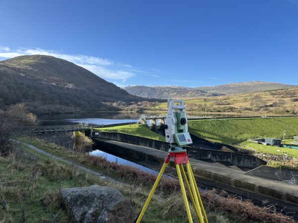
AMTS units are permanently mounted on-site to constantly track critical points of a structure. These systems automatically aim at arrays of prisms fixed to the bridge, rail tracks, or adjacent buildings. By measuring angles and distances at scheduled intervals, they detect structural movement or displacement down to the millimetre and feed that data directly to cloud-based alert systems.
Sensors
While total stations monitor external movement, a variety of discrete sensors capture what’s happening internally and environmentally:
- Tiltmeters and inclinometers measure precise changes in rotation or inclination on bridge piers and retaining walls.
- In-place extensometers track ground settlement or relaxation behind bridge abutments.
- Vibration monitors are placed near active rail lines or motorways to ensure construction activities stay well within safe peak particle velocity (PPV) thresholds.
Laser Scanning
3D laser scanning captures the entire scene. By firing millions of laser points per second, scanning creates highly accurate point clouds of the bridge components. This is invaluable for baseline surveys and checking the structural deformation of a bridge deck over time.
The monitoring timeline
It is commonly thought that monitoring of a live site is only necessary during the active construction is taking place. In actuality, monitoring should consist of three different phases: before, during, and after the works have taken place. To really reduce risk, geospatial observation must begin long before the construction team arrives and continue until the asset is safely settled.
Monitoring before construction
Depending on the project, initial monitoring can begin weeks or sometimes months before construction can begin. This is to capture a base review of the environment where the project is set to take place. It will measure pre-existing vibrations, thermal expansion, fluctuations in traffic volumes and other important information. This means that existing movements on and around the site won’t be mistaken down the line as consequences of construction.
Monitoring during construction
This phase is the most intense stage of the monitoring process. It provides the immediate, millimetre-level feedback loop required to validate engineering assumptions and keep teams moving with confidence and in safety.
Monitoring after construction
While the physical structure is complete, it’s crucial to continue tracking the activity of the area as it settles into its operational role. Post-construction monitoring tracks how the new bridge is performing under its own dead weight and initial activity. This phase provides asset owners, local authorities, and regulatory bodies with proof that the bridge is performing exactly as designed, facilitating a simple compliance sign-off process.
How Malcolm Hughes can help
As infrastructure networks grow tighter and more interconnected, monitoring is no longer a reactive afterthought; it is a preventative necessity that reduces risk before it becomes costly. Partnering with an experienced geospatial expert like Malcolm Hughes Land Surveyors ensures that every structural pulse is captured and your project stays firmly on track.
Get in touch to discuss more about how our real-time bridge health monitoring solutions can safely guide your next live infrastructure project.