 Background
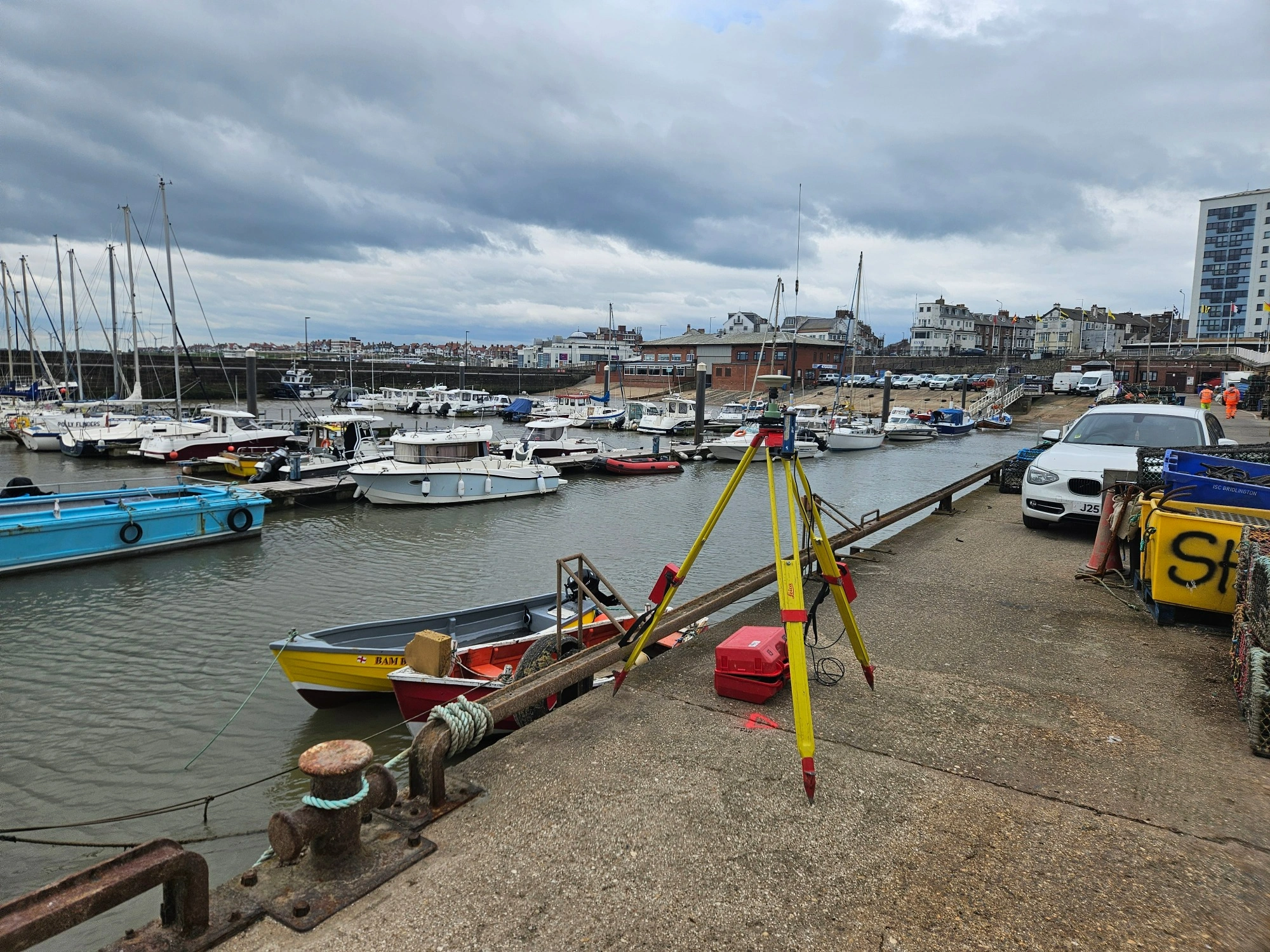
Bridlington Harbour plays an important role on the Yorkshire coast. The landmark site supports commercial fishing, leisure boating, and tourism all throughout the year.
To keep the harbour operating safely, the seabed needs to be monitored regularly. This is so that dredging work can be planned accurately and navigation channels remain suitable for vessels using the harbour. Bridlington Harbour Commissioners appointed us to carry out a bathymetric survey of the harbour ahead of planned dredging works.
The survey formed part of an ongoing monitoring programme and repeated work we completed in May 2025, allowing the client to compare seabed levels over time and identify how sediment had moved across the harbour.
A bathymetric survey is the underwater equivalent of a topographical survey. Instead of measuring ground levels above the surface, it accurately maps the depth and shape of the seabed. This information gives harbour operators the confidence to make informed decisions about dredging, maintenance, and long-term asset management while helping to maintain safe navigation for harbour users.
The challenge
Working in a live harbour environment meant the survey had to be carefully planned around day-to-day operations. Commercial and leisure vessels continued to use the harbour throughout the project, so we needed to complete the survey safely while keeping disruption to a minimum.
The harbour layout also presented access challenges. While much of the seabed could be surveyed from a vessel, areas around pontoons, harbour walls, and other infrastructure were far more restricted. These locations still needed to be captured to provide a complete picture of seabed conditions and allow meaningful comparison with previous survey data.
Weather and tidal conditions added another layer of complexity. Water levels and sea conditions influence both survey safety and data quality, so timing the work correctly was essential to achieve accurate and reliable results within the available survey window.
Our approach
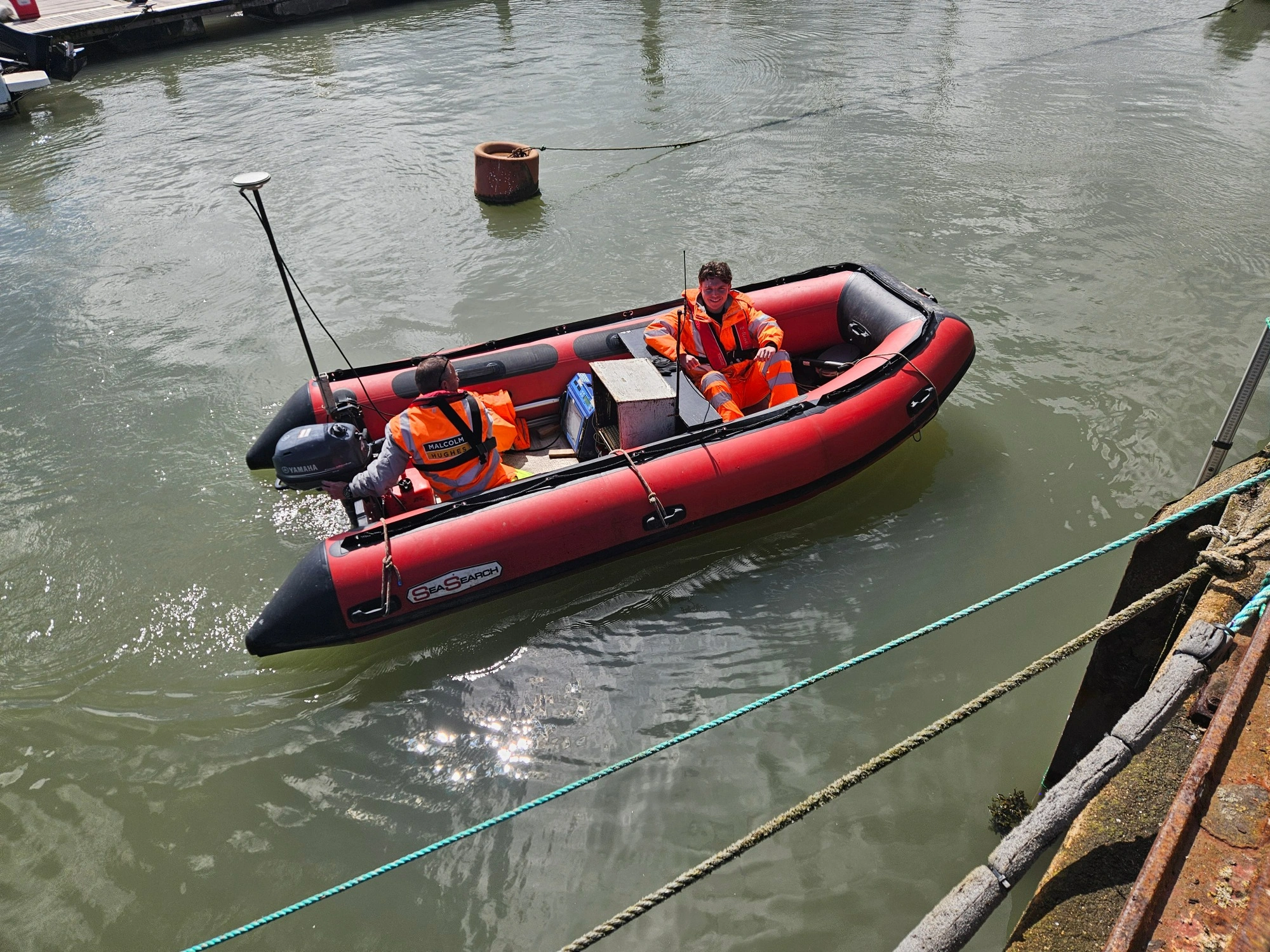
To achieve complete coverage, we combined several survey techniques that complemented one another and allowed us to capture accurate data across the entire harbour. We delivered a fully integrated survey combining:
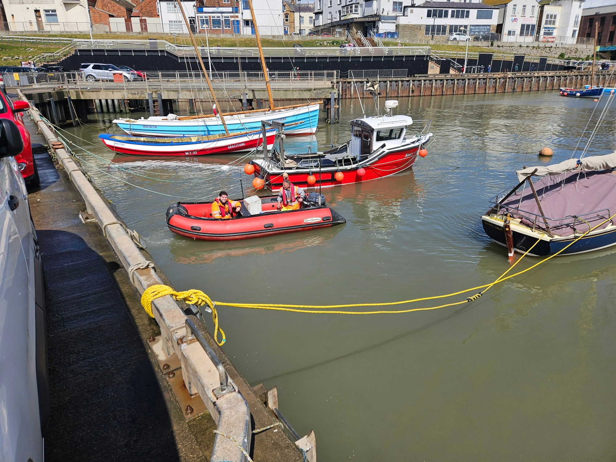
- Single beam echo sounding to measure water depths across the accessible areas of the harbour from a small inflatable survey vessel
- GNSS positioning to accurately locate every depth measurement and align the survey with previous datasets
- Manual depth verification around pontoons and other restricted areas where vessel access was limited
- Survey data processing and quality assurance to validate the final dataset before delivery
Rather than relying solely on boat-based surveying, we combined echo sounding with manual measurements to eliminate gaps in coverage. The echo sounder continuously measured the distance between the water surface and the harbour bed, while GNSS positioning recorded the precise location of every reading.
Where the survey vessel could not safely reach, our surveyors collected manual depth measurements to complete the dataset. Bringing these methods together allowed us to produce a consistent bathymetric model of the entire harbour while maintaining the level of accuracy needed for long-term monitoring.
Throughout the project, we carried out regular equipment checks and on-site data validation before completing further processing and quality assurance once fieldwork had finished.
All work was undertaken in accordance with detailed RAMS, with appropriate PPE, two-person survey teams, and continuous monitoring of site conditions while working on and around water.
What we delivered
The completed bathymetric survey gave the client an accurate picture of seabed conditions across the full extent of Bridlington Harbour. Deliverables included:
- A fully georeferenced bathymetric dataset of harbour bed levels
- Accurate depth information across both open water and restricted areas
- Validated survey data processed in industry-standard formats
- Survey outputs suitable for direct comparison with previous monitoring surveys
The combination of these deliverables gave Bridlington Harbour Commissioners far more than a collection of depth measurements. They received a reliable digital dataset that could be used immediately to support dredging design, monitor sediment movement, and inform future maintenance planning.
Because the survey followed the same repeatable methodology as previous works, the client can continue building a picture of how the harbour bed changes over time.
The outcome
Our survey gave Bridlington Harbour Commissioners the information they needed to plan future dredging works with confidence while strengthening their long-term harbour management strategy.
The repeat survey allowed engineers to compare current seabed levels with previous data. This made it easier to identify where sediment had accumulated and where maintenance efforts should be focused.
This supports better-informed decision-making as it helps to prioritise dredging works while avoiding unnecessary expenditure in areas where intervention is not needed.
The project also showed the value of combining bathymetric survey and hydrographic survey techniques to deliver reliable data within a busy harbour. By achieving complete coverage, including areas that are often difficult to survey, the client gained confidence in the accuracy of the information being used to support maintenance and navigation.
Key benefits included:
- Better-informed dredging and maintenance planning
- Accurate monitoring of sediment movement through repeat surveys
- Complete harbour coverage, including restricted areas
- Reliable depth data to support safe navigation and future asset management
Most importantly, the survey was completed safely and with minimal disruption to ongoing harbour operations. If you need a survey completed in a challenging operational environment, our team is here to help.