Why accurate survey data is important for a project’s success
Your initial site survey dictates every decision that follows. If geospatial data is flawed, it has a ripple effect. Inaccurate or incomplete site information can lead to project delays and severe safety risks. True precision requires a combination of capture methods, rigorous quality control, and expert interpretation.
Below, we’ve discussed why accurate survey data is crucial and what your land surveying partner’s processes should look like to make sure your project stays safe and on schedule.
What is survey data and how is it used?
Survey data is the precise information collected by geospatial surveyors before any construction, refurbishment, or engineering project begins on a site or existing structure.
Types of survey data
Geospatial surveyors gather data across multiple categories using proven methodologies and technology:
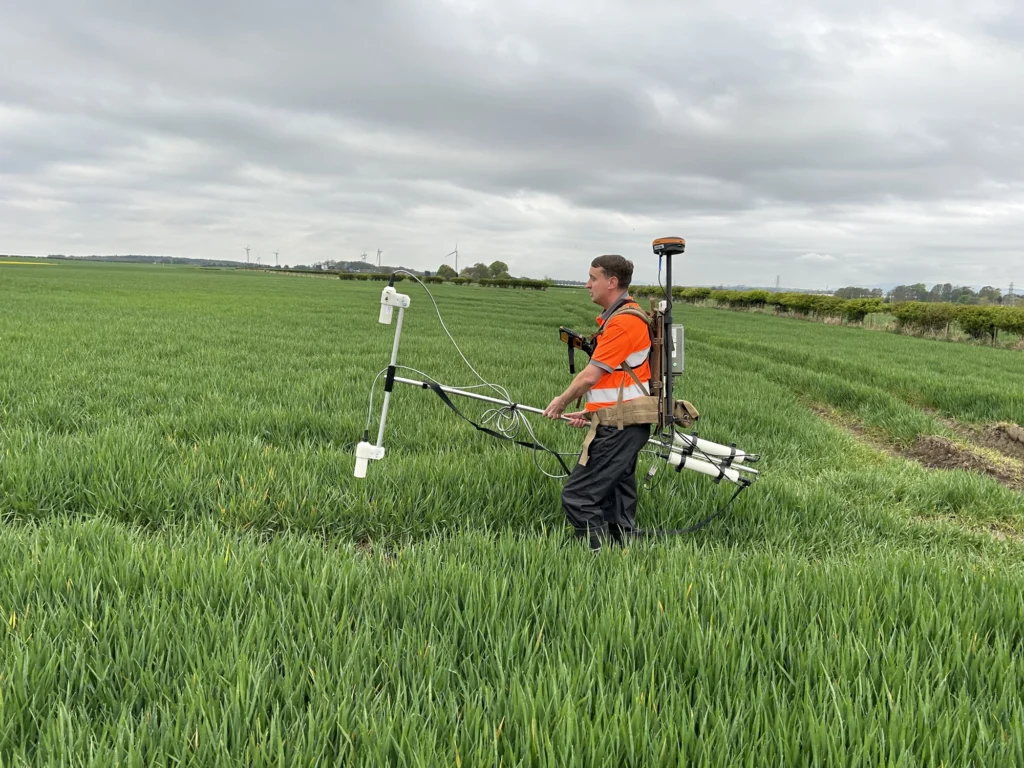
Sub-surface data: Collected using Ground Penetrating Radar (GPR) and Electromagnetic Location (EML) to map underground pipes, ducts, cables, and subterranean features.
Above-ground structure data: Capturing details such as precise physical boundaries, adjacent structures, retaining walls, and access points.
Topographical elevation data: Recording spot heights, slope gradients, changes in level, and terrain variations for earthworks and drainage calculations.
Geodetic and coordinate data: Mapping site locations to national coordinate grids (such as OSGB36) to ensure global positioning accuracy and a universally recognised reference frame across all project stages.
Use across the project timeline
It’s important for Project Managers to implement a survey strategy before works begin to gain total spatial certainty over ground levels, site boundaries, and underground utilities before any physical ground is broken. This helps to:
- Establish true site baselines for architects or civil engineers before designs are started
- Provide validated site plans for local authorities
- Establish a basis from which structural movement and environmental shifts can be tracked
Why accuracy matters during planning and design
A project’s success hinges on the quality of its initial planning and design phase; without accurate data, teams will be going into the construction phase blind.
Maximising design and spatial efficiency
Accurate boundary dimensions support architects in making design decisions that make the most of buildable space, particularly in high-value plots. Furthermore, overlaying structural and civil engineering designs onto a precise 3D survey model allows surveyors to highlight hard and soft clashes based on design plans and structural elements that are already on site.
Regulatory compliance
Exact baseline elevations prevent the building envelope being scaled above local authority height limits. This reduces the likelihood of planning rejection or the necessity for structural modifications after approval. Similarly, spatial surveys provide data that verify boundaries before design completion, preventing disputes with adjacent property owners.
Meeting timeframes and budgets
Running into an unexpected complication on-site in the middle of works can mean skewed timelines and extra costs to cover alterations to planning and design. The right surveys can catch potential roadblocks before work begins.
Supporting safe on-site decisions
Data such as accurate underground mapping protects workers on site from striking high-voltage cables or water infrastructure. Knowing exact ground contours and conditions also allows for the safe movement of heavy machinery and cranes. A reliable geospatial survey will provide crucial evidence that can back up risk assessments and build confidence with local authorities too.
The importance of using the appropriate survey method and technology
When it comes to accurate surveys, there isn’t a singular method or piece of technology that works for every site and every project. Instead, the methodology and tools to be used are chosen based on multiple factors:
Site environment and physical constraints
Between high-density urban areas, heritage sites with restricted access or hazardous infrastructure corridors, physical access restrictions directly dictate whether terrestrial, aerial, or remote sensing methods are needed to capture data safely and effectively.
Required level of detail
Engineering work that is highly structural, like setting out steel frameworks, demands absolute precision with the use of total stations and digital levelling.
On the other hand, sites that need general earthwork volume measurements can be substantially and quickly measured using drone photogrammetry.
Sub-surface vs surface-level features
Capturing surface features requires the use of visual sensors like laser scanners and cameras. When it comes to underground utilities or hidden parts of heritage sites, different tools are needed. Ground Penetrating Radar (GPR) and Electromagnetic Location (EML) equipment map out what’s happening underground, adhering to PAS 128 standards.
Environmental factors
Dense canopy cover and heavy woodland can completely block GNSS (GPS) satellite signals, meaning surveyors must change tactics and rely on optical total stations or vegetation-penetrating LiDAR instead of standard GPS receivers.
Also, ambient features that are out of surveyor control, like lighting and weather, can affect the use of certain equipment. Photogrammetry, for example, needs good lighting and clear weather, so if conditions don’t align with this, this tool shouldn’t be used. Instead, active laser scanning devices emit their own light signals, so they’re the perfect alternative due to their effective operation in darkness and low light.
Combining technologies
Modern surveys rarely use just one piece of equipment. Instead, surveyors often implement multiple tools to produce the most accurate data possible by covering different areas of a site from different angles.
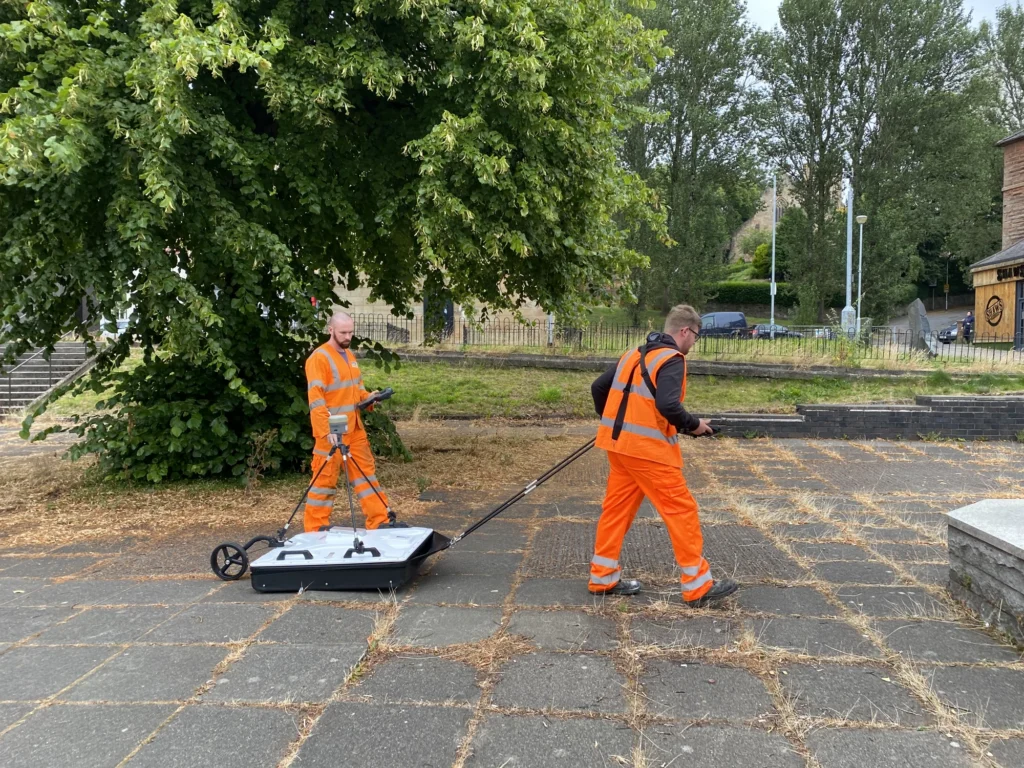
For example, land surveyors can establish a rigid primary control network with high-accuracy total stations, and then use drone imagery, static laser scans, and even subsurface GPR data to build one verified site model with complete visibility from every aspect.
Quality control and data interpretation
Data collection is only part of the process; without expert interpretation, results can be misleading or unusable. Geospatial surveying specialists use rigorous quality assurance systems to guarantee precision:
- Field measurements are tied to official reference points and coordinate grids for geographical accuracy.
- Surveyors start and finish surveys at a known point (known as a closed loop traverse) to calculate and correct any discrepancies.
- Experts manually inspect and filter out unwanted interference like traffic and pedestrians captured by laser scanners and drones so that only the true site data remains.
- They cross-validate, compare, and validate data collected by various methods.
- Before any final drawings or 3D BIM models are sent to clients, a quality manager or secondary surveyor will review datasets to make sure of complete accuracy.
By following the quality control process, geospatial surveyors can provide entirely accurate and clear information to clients with complete confidence.
Different survey data formats
Data is no longer confined to being presented as a flat plan. It can now be supplied in a wide range of digital formats specific to a project’s needs.
2D Computer Aided Design (CAD) drawings
This data format provides topographical site plans, floor plans, structural elevations, and cross-sections. It’s accessible across almost all design software and is easy for teams to read and print.
It is primarily used for standard architectural layouts, planning application submissions, boundary determination, and civil engineering designs.
3D Building Information Models (BIM)
These 3D digital representations of existing structures provide smart visualisation of site features and a source of accuracy for multidisciplinary coordination.
They are primarily used to integrate scan-to-BIM datasets into digital twin workflows and simplify long-term asset management and facilities maintenance.
3D Point Clouds
3D Point Clouds are dense and comprehensive spatial datasets that consist of millions of individual data points, providing photorealistic, geometrically complete visual models of physical site conditions.
They are mainly used to derive 2D and 3D model data but can also be used for a remote first-person view of the site. A picture paints a thousand words, but a point cloud puts you in the centre of the data.
Geographic Information System (GIS) datasets
This dataset informs clients on georeferenced spatial layers linked to detailed attribute databases. They allow the overlapping of multiple layers of data, for example, flood risk zones and property boundaries, making them incredibly beneficial for environmental impact assessments and large-scale infrastructure projects.
Choosing a partner in precision with Malcolm Hughes
No two projects are the same, and neither are their surveying requirements. But achieving truly accurate data takes more than advanced technology alone, it requires a collaborative partner who can guide you in choosing the right methods, interpreting complex results, and maintaining rigorous quality control.
At Malcolm Hughes, we bring over 50 years of industry experience to every site. We work alongside you as a trusted partner, tailoring our survey solutions to your unique challenges. Whether you are an architect, engineer, or developer, our team provides the expert guidance and project-specific data you need to make confident, informed decisions at every stage.
Build your project on a foundation of certainty. Get in touch with our expert team today to discuss your next project.